
Few physiographic regions in India appear as consistently across UPSC papers as the one that stretches from the Vindhyas down to the southern tip of Karnataka. I have seen aspirants study it once for a Geography class and then encounter the same landmass in Economy questions about minerals, agriculture, and industrial corridors. Understanding this region deeply gives you an edge in at least two General Studies papers.
This piece walks you through the physiography, soil systems, mineral wealth, agricultural economy, and exam strategy tied to this single peninsular landform. Whether you are preparing for Prelims or writing a Mains answer on regional development, this will serve as your consolidated resource.
Where This Topic Sits in the UPSC Syllabus
This topic straddles two major papers. In Geography, it falls under Indian Physical Geography. In Economy, it connects to mineral resources, agriculture, and industrial development. Here is a quick mapping.
| Exam Stage | Paper | Syllabus Section |
|---|---|---|
| Prelims | General Studies | Indian Geography — Physical Features of India |
| Mains | GS-I | Salient features of Indian Physical Geography; Distribution of Key Natural Resources |
| Mains | GS-III | Indian Economy — Land Resources, Minerals, Industrial Policy |
Questions from this region have appeared in Prelims almost every alternate year — sometimes directly, sometimes embedded within questions on rivers, soils, or mineral belts. In Mains, GS-I and GS-III both draw from this area. Related topics include the Western Ghats biodiversity, peninsular river systems, and India’s mineral policy.
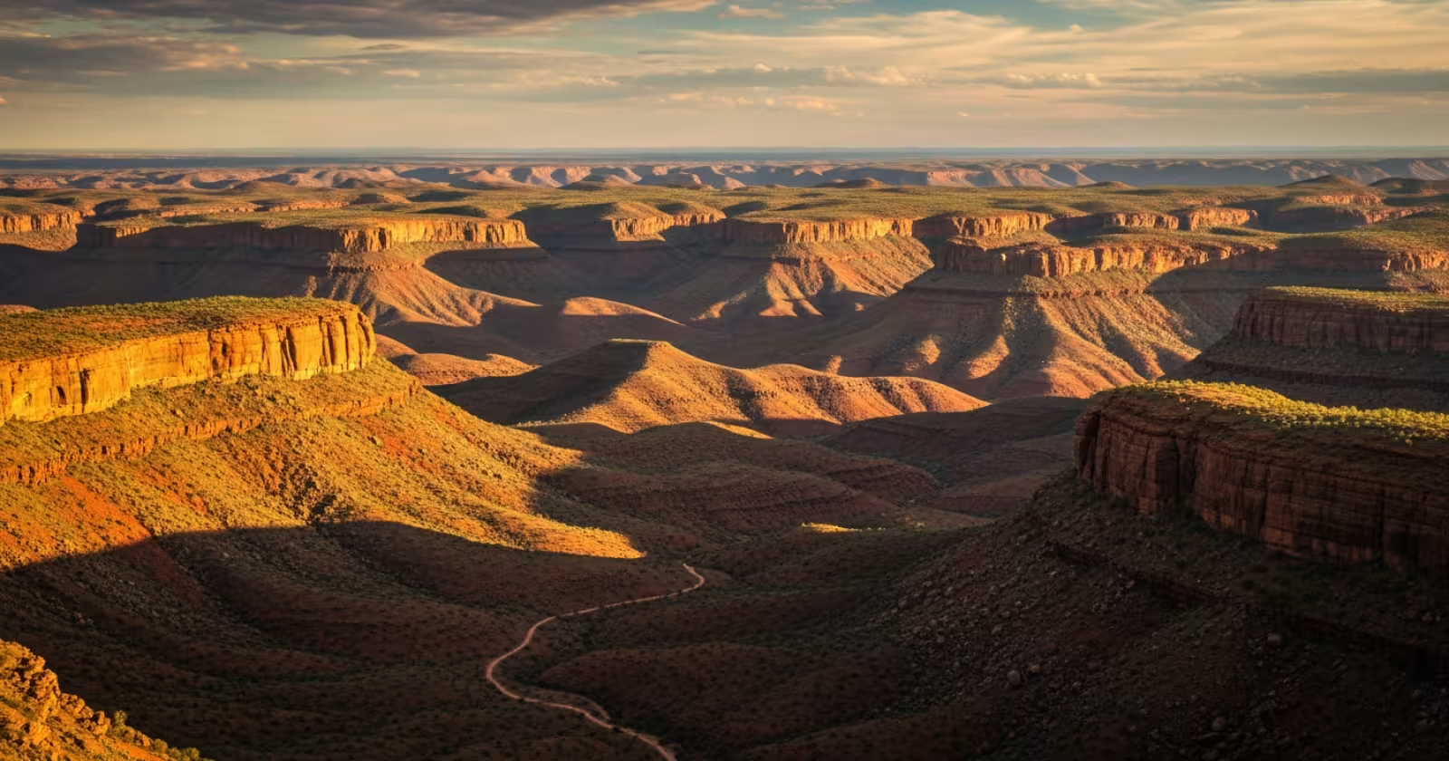
Physiography — The Foundation You Must Know
The Deccan Plateau is the largest physiographic unit of peninsular India. It is a triangular tableland bounded by the Western Ghats on the west, the Eastern Ghats on the east, and the Satpura-Vindhya ranges to the north. Its average elevation is about 600 metres on the western side and gradually slopes eastward to around 300 metres.
This westward tilt is the reason most peninsular rivers — the Godavari, Krishna, Kaveri, and Mahanadi — flow eastward into the Bay of Bengal. UPSC loves testing this directional logic. If you remember just one line, let it be this: the plateau tilts from west to east, and so do its rivers.
The plateau is further divided into sub-regions. The Maharashtra Plateau in the north-west is dominated by Deccan Trap basalt — a result of massive volcanic activity about 65 million years ago. The Karnataka Plateau (also called the Mysore Plateau) is one of the oldest landmasses on Earth, part of the Dharwar geological system. The Telangana Plateau lies in between, acting as a transition zone.
Soils — Where Geography Meets Agriculture
The volcanic origin of the western Deccan gave India its most distinctive soil: Black Cotton Soil (Regur). This soil is rich in iron, aluminium, calcium, and magnesium. It has a high moisture-retention capacity, which makes it ideal for cotton cultivation even without irrigation. This is why Maharashtra and parts of Gujarat became the cotton belt of India.
Moving eastward, you encounter Red Soil derived from the weathering of ancient crystalline and metamorphic rocks. Red soils dominate in Karnataka, Telangana, and parts of Tamil Nadu. They are less fertile than black soil but respond well to irrigation and fertilisers. Laterite soils appear along the plateau edges, especially near the Western Ghats, where heavy rainfall causes intense leaching.
For UPSC, always connect soil type to the parent rock and the crop it supports. The examiner is testing whether you understand the chain: geology → soil → agriculture → economy.
Mineral Wealth — The Economy Dimension
This is where the plateau transforms from a Geography topic into an Economy topic. The Dharwar and Cuddapah geological formations that underlie much of the southern Deccan are among India’s richest mineral zones.
Iron Ore: The Bellary-Hospet belt in Karnataka and the Bailadila mines in Chhattisgarh (on the plateau’s eastern fringe) are major iron ore sources. India is one of the world’s top iron ore producers, and the Deccan contributes significantly.
Manganese: Maharashtra and Madhya Pradesh hold large manganese deposits in the Deccan Trap region. Manganese is essential for steel production, making this an industrial raw material question as well.
Bauxite: The laterite-capped plateaus of Jharkhand, Odisha, and parts of Maharashtra yield bauxite — the ore for aluminium. The Amarkantak Plateau and the East Coast bauxite deposits are linked to Deccan geology.
Coal: The Godavari-Pranhita valley in Telangana contains Gondwana coal deposits. While not as large as the Damodar valley reserves, these are strategically significant for southern India’s energy needs.
When you study minerals for UPSC, do not just memorise names. Understand why a mineral is found in a specific geological formation. The Deccan Trap yields iron and manganese because basaltic lava is rich in these elements. Laterite yields bauxite because aluminium concentrates during tropical weathering. This kind of reasoning fetches marks in Mains.
Agriculture and Water — The Livelihood Connection
Rain-fed agriculture dominates the Deccan. The region falls in India’s rain shadow zone east of the Western Ghats. Districts in Maharashtra’s Marathwada, Karnataka’s Hyderabad-Karnataka, and Telangana’s Rayalaseema face chronic drought. This is why the Deccan has been central to debates on irrigation policy, inter-state river disputes, and farmer distress.
Major crops include cotton, jowar (sorghum), groundnut, sunflower, and pulses. Sugarcane cultivation in western Maharashtra has been a politically powerful but ecologically controversial practice — it consumes enormous water in a water-scarce zone. UPSC has asked about such contradictions in resource allocation.
The Krishna-Godavari river water dispute between Maharashtra, Karnataka, Telangana, and Andhra Pradesh is rooted in the plateau’s hydrology. Similarly, the Kaveri water dispute between Karnataka and Tamil Nadu originates in the Deccan’s rainfall patterns. These are perennial Mains topics.
Industrial and Urban Growth
The plateau today hosts some of India’s fastest-growing urban economies. Bengaluru, Hyderabad, and Pune — all Deccan cities — are IT and manufacturing hubs. The Delhi-Mumbai Industrial Corridor (DMIC) and the Chennai-Bengaluru Industrial Corridor (CBIC) both pass through plateau territory.
For GS-III answers on industrial policy or urbanisation, linking physical geography to economic development shows the examiner that you think in an integrated manner. A simple line like “the plateau’s stable geological base and availability of mineral resources supported early industrialisation in cities like Pune and Bengaluru” can elevate your answer.
Previous Year UPSC Questions on This Topic
Q1. Consider the following pairs: Region — Well-known for production of: 1. Kinnaur — Areca nut 2. Mewat — Mango 3. Coromandel — Soya bean. Which of the above pairs is/are correctly matched?
(UPSC Prelims 2015 — GS)
Answer: None of the pairs is correctly matched. Kinnaur is known for apples, Mewat for crops like mustard, and Coromandel (eastern Deccan coast) for rice. The question tests whether you can connect Indian sub-regions to their actual agricultural produce rather than guessing based on general knowledge.
Q2. What is the significance of the Deccan Trap in Indian geography?
(UPSC Mains-type analytical question — GS-I)
Answer: The Deccan Trap refers to a massive basaltic lava province covering nearly 500,000 sq km of western and central India. Formed during the late Cretaceous period, it created a flat-topped landscape with step-like hills (hence “trap” from the Swedish word for stairs). Its weathering produced fertile black cotton soil that supports rain-fed cotton and oilseed farming. The basaltic rock hosts iron ore, manganese, and other metallic minerals. The Trap also influences groundwater availability — basalt is a poor aquifer, contributing to water scarcity in Marathwada and Vidarbha. Understanding its geological origin connects physical geography to agriculture, mineral economics, and drought management.
Q3. Discuss the factors responsible for the concentration of iron and steel industries in the Chotanagpur-Odisha belt and the Deccan region of Karnataka.
(UPSC Mains-type question — GS-III)
Answer: The concentration arises from proximity to raw materials — iron ore from Bailadila and Bellary-Hospet, manganese from adjacent deposits, and limestone from Cuddapah formations. Coal availability from the Godavari valley and Damodar basin provides energy. Port connectivity via Visakhapatnam and Mangalore enables exports. Government policies like Freight Equalisation Policy historically affected location choices but its removal post-1991 re-concentrated industry near ore sources. The Dharwar geological system underlying Karnataka provides high-grade haematite ore, giving the Deccan a natural advantage for steel and ferro-alloy industries.
Key Points to Remember for UPSC
- The Deccan Plateau tilts west to east, causing all major peninsular rivers to flow into the Bay of Bengal.
- Deccan Trap basalt covers western and central India, producing black cotton soil ideal for rain-fed cotton and jowar.
- The Dharwar and Cuddapah geological systems in the southern Deccan are rich in iron ore, manganese, and bauxite.
- Marathwada, Rayalaseema, and Hyderabad-Karnataka lie in the rain shadow zone — chronic drought areas linked to farmer distress.
- Inter-state river disputes (Krishna, Godavari, Kaveri) originate from the plateau’s hydrology and uneven rainfall distribution.
- Laterite soils on plateau edges yield bauxite; this connects physical geography directly to aluminium industry economics.
- Modern industrial corridors (DMIC, CBIC) and IT hubs like Bengaluru and Hyderabad are located on the Deccan — useful for GS-III urbanisation answers.
The Deccan is one of those rare topics where a single chapter can prepare you for questions across multiple papers. My suggestion is to study it with a physical map beside you — mark the rivers, soil zones, mineral belts, and industrial cities together. Once you see the connections visually, you will never forget them. Build this integrated understanding now, and it will serve you in both Prelims and Mains for years to come.
Get fastest alerts on Results, Admit Cards & Govt Jobs directly on your phone.