
India uses more groundwater than any other country on Earth — roughly 25% of the global total. Yet most UPSC aspirants study groundwater either as a physical geography topic or as a policy issue, never connecting the two. That connection is exactly where the UPSC examiner likes to set traps, and that is what we will build today.
Where This Topic Sits in the UPSC Syllabus
Groundwater sits at a unique crossroads in the UPSC framework. It appears in both Prelims and Mains, and the examiner can frame questions from a science angle, a geography angle, or a governance angle. Here is how it maps across papers.
| Exam Stage | Paper | Syllabus Section |
|---|---|---|
| Prelims | General Studies | Indian and World Geography — Physical, Social, Economic |
| Mains | GS-I | Distribution of Key Natural Resources — Water |
| Mains | GS-III | Conservation, Environmental Pollution and Degradation |
| Mains | GS-III | Disaster Management (drought linkage) |
| Mains | GS-II | Government Policies and Interventions (Atal Bhujal Yojana, Jal Shakti) |
Questions on groundwater have appeared at least 8-10 times in the last decade across Prelims and Mains. The 2018 NITI Aayog Composite Water Management Index report triggered multiple questions. Related topics include watershed management, irrigation policy, river interlinking, and drought management.
Understanding Groundwater — The Physical Geography Foundation
Groundwater is water stored beneath the Earth’s surface in spaces within soil, sand, and rock formations. These formations are called aquifers. An aquifer is simply a rock layer that can hold and transmit water. Think of it like a giant underground sponge.
There are two main types. Unconfined aquifers sit close to the surface with no impermeable layer above them. Rainwater seeps directly into them. Confined aquifers are deeper, sandwiched between impermeable rock layers. They hold water under pressure and are harder to recharge naturally.
India’s groundwater geography is shaped by its geology. The Indo-Gangetic alluvial plains have deep, productive aquifers because alluvial soil is porous and holds water well. Hard rock regions of peninsular India — Deccan basalt, granite shields — have poor aquifer capacity. Water gets trapped only in fractures and weathered zones. This geological difference is the root cause of unequal groundwater availability across India.
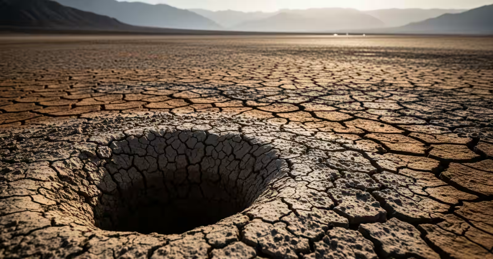
Why India’s Groundwater Is Disappearing
The Central Ground Water Board (CGWB) classifies groundwater units into safe, semi-critical, critical, and over-exploited categories. As of recent assessments, over 1,000 blocks across India are classified as over-exploited. Punjab, Haryana, Rajasthan, and Tamil Nadu are the worst affected states.
The reasons are layered. First, the Green Revolution pushed water-intensive crops like rice and wheat into regions not naturally suited for them. Punjab grows paddy in a semi-arid climate, using borewells that extract far more water than monsoon rains can recharge. Second, electricity subsidies for agriculture made pumping virtually free. When water has no price, there is no incentive to conserve it.
Third, urbanisation has sealed vast areas of natural recharge zones with concrete. Cities like Bengaluru and Chennai have seen dramatic water table drops because rainwater cannot percolate into the ground anymore. Fourth, climate variability has made monsoons erratic, reducing the recharge window.
The Policy Response — From Awareness to Action
India’s policy journey on groundwater has been slow but is now accelerating. The National Water Policy 2012 recognised groundwater as a common pool resource needing regulation. But regulation at the ground level remains weak because water is a State subject under the Constitution (Entry 17, State List).
The Atal Bhujal Yojana, launched in 2020, is the most significant central scheme focused specifically on groundwater. It covers seven states — Gujarat, Haryana, Karnataka, Madhya Pradesh, Maharashtra, Rajasthan, and Uttar Pradesh. The scheme has two components: institutional strengthening and incentive-based management. Communities that demonstrate improved groundwater practices receive higher fund allocations. This demand-side approach is new for India.
The Jal Shakti Abhiyan focuses on water conservation in water-stressed districts through rainwater harvesting, traditional water body restoration, and reuse of treated wastewater. Aquifer mapping by CGWB is another ongoing effort — it aims to map every major aquifer system so that extraction limits can be set scientifically.
The Model Bill for Groundwater Regulation was circulated to states, but adoption has been uneven. States are reluctant to restrict borewell drilling because it is politically sensitive. This is a classic governance challenge that the UPSC loves to test in GS-II and GS-III.
The Geography-Policy Bridge — What the UPSC Examiner Wants
Here is what many aspirants miss. The UPSC does not want you to describe physical geography and policy in separate boxes. It wants you to connect them. A strong answer on groundwater should explain how the alluvial geology of Punjab enables deep extraction, how the Green Revolution policy exploited that geology, and how current schemes like Atal Bhujal Yojana are trying to reverse the damage.
When you write about peninsular India’s hard rock aquifers, link it to why borewells fail in Maharashtra’s Marathwada region during droughts. When you mention urban flooding in Chennai, connect it to the destruction of natural recharge zones and the subsequent groundwater crisis of 2019.
This layered thinking — geology shapes availability, policy shapes extraction, and climate shapes recharge — is exactly the analytical depth that scores 10+ marks in Mains.
Previous Year UPSC Questions on This Topic
Q1. What are the consequences of spreading of irrigation in dry regions of India? (UPSC Mains 2016 — GS-I)
Answer: Spreading irrigation into dry regions through borewells and canals has led to waterlogging and salinity in canal-fed areas, and rapid groundwater depletion in borewell-dependent zones. In Rajasthan, the Indira Gandhi Canal brought irrigation but also raised water tables dangerously in some areas, causing salt accumulation. In Punjab and Haryana, over-extraction for paddy cultivation has created a crisis where the water table drops by 1 metre per year in some districts. Ecologically, wetlands have dried up and land subsidence has begun in parts of Jaipur and Lucknow. The lesson is that irrigation expansion without hydrogeological assessment leads to long-term environmental damage.
Explanation: This question tests the link between physical geography and agricultural policy — exactly the bridge discussed above. The examiner wanted candidates to go beyond listing benefits of irrigation and discuss negative consequences with regional examples.
Q2. Which of the following is/are the cause(s) of water crisis in India? 1. Increasing population 2. Over-exploitation of groundwater 3. Uneven distribution of rainfall. Select the correct answer. (UPSC Prelims Style)
Answer: All three are correct. India’s water crisis is multi-causal. Population growth increases demand, over-exploitation depletes reserves faster than recharge, and uneven monsoon distribution means some regions face chronic scarcity. The CGWB data confirms that over 60% of India’s irrigation and 85% of drinking water depends on groundwater.
Explanation: Prelims questions on water typically test whether candidates understand that the crisis is systemic, not caused by a single factor. Elimination-based approaches fail here — all three are valid.
Q3. Suggest measures to improve water storage and irrigation in the context of groundwater depletion. (UPSC Mains 2017 — GS-III)
Answer: Improving water storage requires both supply-side and demand-side interventions. On the supply side, rejuvenation of traditional water bodies like tanks, johads, and step wells can enhance surface storage and natural recharge. Managed aquifer recharge through percolation pits and check dams can replenish groundwater. On the demand side, micro-irrigation — drip and sprinkler systems — can reduce agricultural water use by 30-50%. Crop diversification away from water-intensive rice and sugarcane in stressed zones is essential. Regulatory measures like mandatory rainwater harvesting in urban areas and metering of agricultural borewells can bring discipline. The Atal Bhujal Yojana’s community incentive model offers a promising framework for participatory groundwater management.
Explanation: This question demanded practical solutions, not just problem description. The examiner wanted a mix of traditional knowledge, modern technology, and governance reform. Mentioning specific schemes and techniques strengthens the answer significantly.
Key Points to Remember for UPSC
- Aquifer type determines availability — alluvial aquifers in the north are productive; hard rock aquifers in peninsular India have limited capacity.
- India extracts roughly 25% of global groundwater, making it the largest user worldwide.
- Over 1,000 blocks are classified as over-exploited by CGWB, concentrated in Punjab, Haryana, Rajasthan, and Tamil Nadu.
- Free electricity for agriculture is a major driver of over-extraction — pricing reform is politically difficult but necessary.
- Atal Bhujal Yojana covers 7 states and uses an incentive-based, community-driven model for groundwater management.
- Water is a State subject (Entry 17, State List), which limits central regulation and makes uniform policy adoption challenging.
- Urban groundwater crises (Chennai 2019, Bengaluru’s declining water table) are linked to destruction of natural recharge zones by construction.
- For Mains answers, always connect physical geography (geology, rainfall) to policy outcomes (Green Revolution, subsidies) — this layered approach scores well.
Groundwater is one of those rare topics where your understanding of rock types, monsoon patterns, and government schemes must come together in a single answer. I recommend practising at least two Mains-type questions where you deliberately build the geology-to-policy chain in your response. Start with the CGWB’s latest assessment report and the Atal Bhujal Yojana guidelines — both are freely available online and give you data points that make your answers stand out.
Get fastest alerts on Results, Admit Cards & Govt Jobs directly on your phone.