
Every grain of rice on your plate has a direct connection to a cloud that formed over the Arabian Sea months ago. Understanding this chain — from moisture-laden winds to harvested crops — is one of the most rewarding exercises for any UPSC aspirant preparing GS-III.
I have seen students study rainfall and agriculture as two separate chapters. That is a mistake. The UPSC examiner consistently tests your ability to connect physical geography with economic geography. This article builds that bridge for you, step by step.
Where This Topic Sits in the UPSC Syllabus
Rainfall patterns fall under Physical Geography for Prelims and under GS-I (Salient features of World Physical Geography) for Mains. Agriculture falls under GS-III. But the real magic happens when questions demand you link both — and those questions appear in GS-III under “Major crops, cropping patterns, irrigation, and agricultural issues.”
| Exam Stage | Paper | Syllabus Section |
|---|---|---|
| Prelims | General Studies | Indian and World Geography — Physical, Social, Economic |
| Mains | GS-I | Salient features of World Physical Geography; Distribution of key natural resources |
| Mains | GS-III | Major crops, cropping patterns, irrigation, and effects of liberalisation on agriculture |
This cross-paper linkage makes the topic a favourite for UPSC. Questions have appeared directly or indirectly in at least 8-10 Prelims papers over the last 15 years.
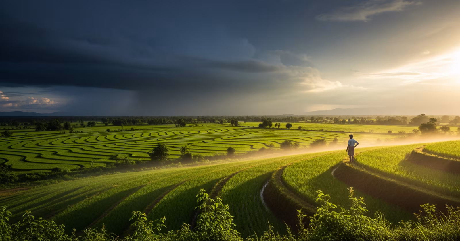
The Indian Monsoon — Engine of Indian Agriculture
India receives about 75-80% of its total annual rainfall during the Southwest Monsoon season, from June to September. This four-month window determines the fate of the Kharif crop — rice, maize, cotton, sugarcane, and pulses like moong and urad.
The monsoon originates from two branches. The Arabian Sea branch strikes the Western Ghats first, delivering heavy rainfall to Kerala, Karnataka’s coast, and Konkan. The Bay of Bengal branch moves towards the northeast and then curves westward along the Indo-Gangetic plain. The timing, intensity, and distribution of these branches decide which regions get adequate rain and which face drought.
For UPSC, remember this: the monsoon is not uniform. Cherrapunji receives over 11,000 mm annually. Jaisalmer gets barely 150 mm. Both are in India. This variation is the foundation of India’s diverse cropping patterns.
Rainfall Distribution and Its Geographic Causes
Three geographic factors control where rain falls and how much. First is orography — mountains force moist air upward, causing condensation. The Western Ghats create a classic rain shadow. The windward side (Konkan, Malabar) gets 2000-3000 mm. The leeward side (Deccan Plateau) gets 500-700 mm. This single geographic fact explains why paddy dominates in coastal Karnataka while jowar and bajra dominate in interior Maharashtra.
Second is distance from the sea. As monsoon winds travel inland, they lose moisture progressively. Punjab and Haryana receive far less monsoon rain than Bengal or Odisha. This is why the Green Revolution in Punjab relied heavily on canal irrigation and tubewells, not rainfall.
Third is the role of cyclonic depressions. The Bay of Bengal generates low-pressure systems that pull monsoon winds deeper into the subcontinent. When these depressions are weak or fewer in number, central India — Madhya Pradesh, Vidarbha, Marathwada — faces severe rainfall deficits. These are also India’s most agrarian distress-prone regions.
How Rainfall Shapes Cropping Patterns Across India
I always tell my students to think of India in four rainfall zones when connecting geography to agriculture.
Areas receiving above 200 cm — the northeast, Western Ghats coast, and parts of West Bengal — grow rice as the dominant crop. Plantation crops like tea, coffee, rubber, and spices also thrive here because of consistent moisture and humidity.
Areas receiving 100-200 cm — the middle Gangetic plain, eastern Madhya Pradesh, and coastal Andhra — also grow rice but supplement it with sugarcane and jute. These areas have alluvial soils that retain moisture well.
Areas receiving 50-100 cm — western Uttar Pradesh, parts of Punjab, Gujarat, and the Deccan Plateau — shift towards wheat, cotton, groundnut, and millets. Irrigation becomes essential here, and this is where canal systems and groundwater extraction are most intensive.
Areas receiving below 50 cm — western Rajasthan, Kutch, and Ladakh — support only drought-resistant crops like bajra, guar, and dates. Pastoral farming is more common than settled agriculture.
The Irrigation Bridge — When Rainfall Is Not Enough
India irrigates only about 55% of its net sown area as of 2026. The remaining 45% is entirely rain-dependent, which makes it vulnerable to monsoon variability. This is called rainfed agriculture, and it supports nearly 40% of India’s food production.
The government has launched several schemes to reduce this dependence. The Pradhan Mantri Krishi Sinchayee Yojana (PMKSY) aims to expand irrigation coverage with the slogan “Har Khet Ko Paani.” Micro-irrigation techniques like drip and sprinkler systems are being promoted in water-scarce states like Maharashtra and Rajasthan.
For UPSC Mains, always connect rainfall deficiency to irrigation policy. The examiner wants to see that you understand the problem (erratic rainfall) and the solution (irrigation reform, watershed management, rainwater harvesting) as a single chain.
Climate Change and Shifting Rainfall — A GS-III Priority
India Meteorological Department (IMD) data shows that while total monsoon rainfall has remained broadly stable over decades, its distribution has changed. Extreme rainfall events — very heavy rain in 1-2 days followed by long dry spells — are increasing. This pattern is devastating for agriculture because crops need steady moisture, not sudden floods.
States like Kerala, Maharashtra, and Assam have faced unprecedented flooding in recent years, destroying standing crops. Simultaneously, traditional high-rainfall areas in central India have experienced prolonged dry spells mid-monsoon, ruining Kharif sowing.
The Pradhan Mantri Fasal Bima Yojana (PMFBY) was designed partly to address this unpredictability. Crop insurance linked to weather data is now a standard UPSC topic under both agriculture and disaster management.
Previous Year UPSC Questions on This Topic
Q1. Consider the following crops: 1. Cotton 2. Groundnut 3. Rice 4. Wheat. Which of these are Kharif crops?
(UPSC Prelims 2013 — GS)
Answer: Cotton, Groundnut, and Rice are Kharif crops. Wheat is a Rabi crop sown in winter and harvested in spring. Kharif crops depend on Southwest Monsoon rainfall and are sown between June and July.
Explanation: This question tests basic knowledge of crop seasonality, which is directly linked to monsoon timing. The examiner expects you to know that monsoon rainfall drives Kharif cropping.
Q2. “The rain shadow area in India receives less than 60 cm of rainfall.” Discuss the geographic factors responsible and their impact on agriculture in the Deccan Plateau.
(UPSC Mains 2016 — GS-I, 15 marks)
Answer approach: Begin with the orographic mechanism of the Western Ghats blocking Arabian Sea branch moisture. Explain how the leeward Deccan Plateau — Marathwada, Vidarbha, Telangana — receives depleted rainfall. Connect this to dominance of millets, pulses, and cotton. Discuss agrarian distress, farmer suicides, and the need for watershed development and drought-proofing. End with policy measures like PMKSY and MGNREGA-linked water conservation.
Explanation: This is a classic cross-paper question. Though placed in GS-I, the agricultural dimension makes it relevant for GS-III preparation too. The examiner rewards candidates who link physical geography to socio-economic outcomes.
Q3. How does the variability of the Indian monsoon affect food security in India? Suggest measures to mitigate the impact.
(UPSC Mains 2019 — GS-III, 15 marks)
Answer approach: Define monsoon variability — spatial and temporal. Explain impact on Kharif output, procurement, buffer stocks, and food prices. Mention El Nino and La Nina effects on Indian monsoon. Suggest measures: expanding irrigation, promoting drought-resistant varieties, crop insurance (PMFBY), climate-smart agriculture, diversification towards millets.
Explanation: This question sits squarely at the rainfall-agriculture junction. The examiner wants a structured answer that moves from problem to solution, showing both geographic understanding and policy awareness.
Key Points to Remember for UPSC
- Southwest Monsoon (June-September) delivers 75-80% of India’s annual rainfall and drives the entire Kharif season.
- The Western Ghats create a sharp rain shadow — windward side gets 2000+ mm, leeward Deccan gets 500-700 mm, directly shaping crop choices.
- Nearly 45% of India’s net sown area remains rainfed, making agriculture highly vulnerable to monsoon variability.
- Extreme rainfall events are increasing due to climate change, even as total seasonal rainfall stays roughly the same.
- Cropping pattern follows a clear rainfall gradient — rice in high-rainfall zones, wheat and millets in moderate to low-rainfall zones.
- PMKSY and PMFBY are the two key government responses linking rainfall uncertainty to agricultural policy.
- Bay of Bengal cyclonic depressions are critical for pulling monsoon moisture into central India — their frequency affects Vidarbha and Marathwada directly.
Rainfall and agriculture are not two separate topics for UPSC — they are two sides of the same coin. Build a mental map that connects wind patterns to soil moisture to crop selection to government policy. Practice drawing India’s rainfall distribution map by hand at least once. When you can trace the journey of a monsoon wind from the Arabian Sea to a paddy field in Bihar, you are truly ready for GS-III.
Get fastest alerts on Results, Admit Cards & Govt Jobs directly on your phone.